1.034.908
kiadvánnyal nyújtjuk Magyarország legnagyobb antikvár könyv-kínálatát

The Great World Atlas


| Kiadó: | American Map Corporation |
|---|---|
| Kiadás helye: | New York |
| Kiadás éve: | |
| Kötés típusa: | Fűzött keménykötés |
| Oldalszám: | 383 oldal |
| Sorozatcím: | |
| Kötetszám: | |
| Nyelv: | Angol |
| Méret: | 36 cm x 27 cm |
| ISBN: | 0-8416-2003-2 |
| Megjegyzés: | Színes fotókkal, illusztrációkkal, térképekkel. |
Értesítőt kérek a kiadóról
A beállítást mentettük,
naponta értesítjük a beérkező friss
kiadványokról
naponta értesítjük a beérkező friss
kiadványokról
A beállítást mentettük,
naponta értesítjük a beérkező friss
kiadványokról
naponta értesítjük a beérkező friss
kiadványokról
Fülszöveg
THE GREAT WORLD ATLAS
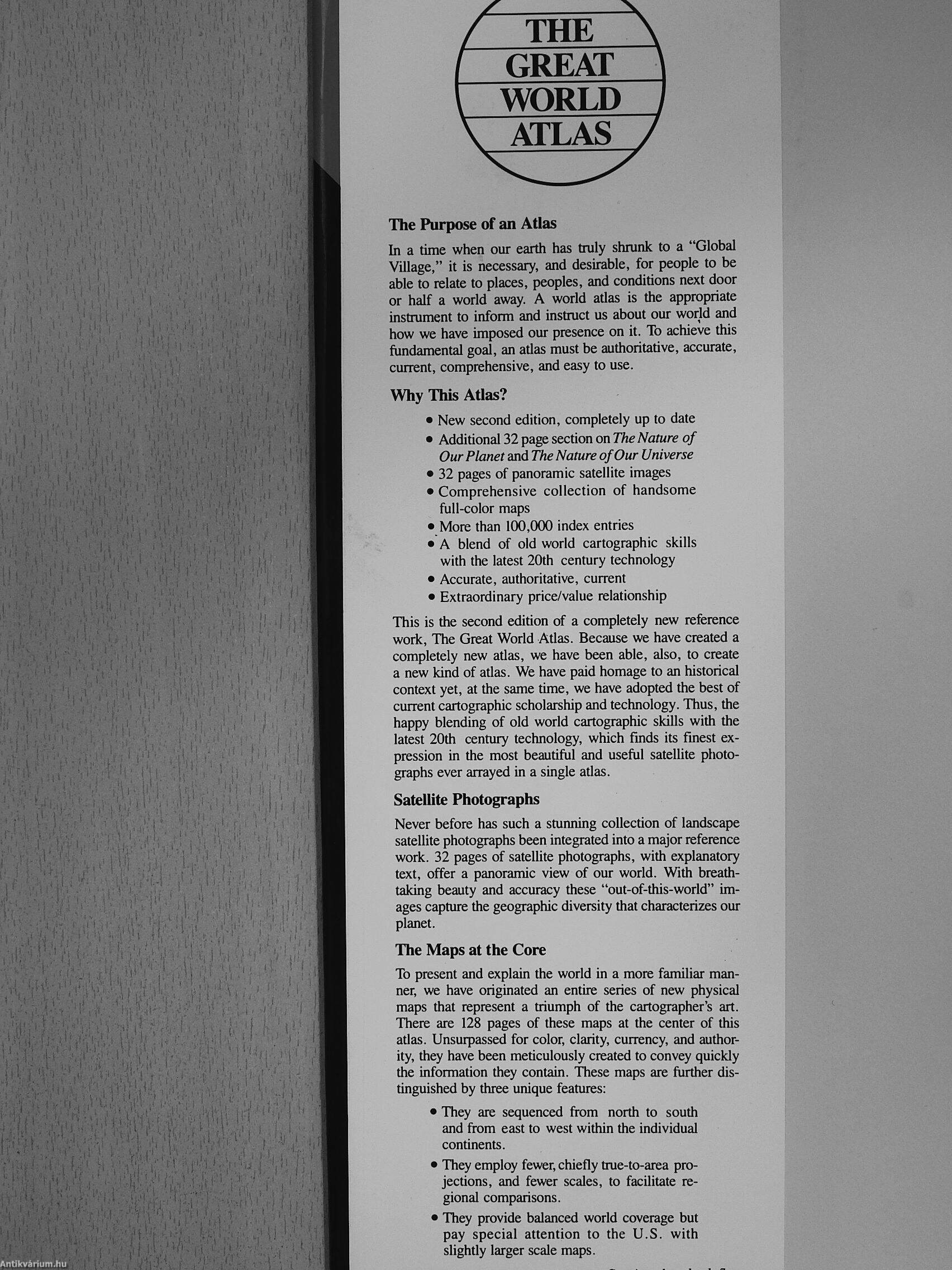
The Purpose of an Atlas
In a time when our earth has truly shrunk to a "Global Village," it is necessary, and desirable, for people to be able to relate to places, peoples, and conditions next door or half a world away. A world adas is the appropriate instrument to inform and instruct us about our world and how we have imposed our presence on it. To achieve this fundamental goal, an atlas must be authoritative, accurate, current, comprehensive, and easy to use.
Why This Atlas?
• New second edition, completely up to date
• Additional 32 page section on The Nature of Our Planet and The Nature of Our Universe
• 32 pages of panoramic satellite images
• Comprehensive collection of handsome full-color maps
• More than 100,000 index entries
• A blend of old world cartographic skills with the latest 20th century technology
• Accurate, authoritative, current
• Extraordinary price/value relationship
This is the second edition of a completely new reference... Tovább
Fülszöveg
THE GREAT WORLD ATLAS
The Purpose of an Atlas
In a time when our earth has truly shrunk to a "Global Village," it is necessary, and desirable, for people to be able to relate to places, peoples, and conditions next door or half a world away. A world adas is the appropriate instrument to inform and instruct us about our world and how we have imposed our presence on it. To achieve this fundamental goal, an atlas must be authoritative, accurate, current, comprehensive, and easy to use.
Why This Atlas?
• New second edition, completely up to date
• Additional 32 page section on The Nature of Our Planet and The Nature of Our Universe
• 32 pages of panoramic satellite images
• Comprehensive collection of handsome full-color maps
• More than 100,000 index entries
• A blend of old world cartographic skills with the latest 20th century technology
• Accurate, authoritative, current
• Extraordinary price/value relationship
This is the second edition of a completely new reference work, The Great World Atlas. Because we have created a completely new atlas, we have been able, also, to create a new kind of atlas. We have paid homage to an historical context yet, at the same time, we have adopted the best of current cartographic scholarship and technology. Thus, the happy blending of old world cartographic skills with the latest 20th century technology, which finds its finest expression in the most beautiful and useful satellite photographs ever arrayed in a single atlas.
Satellite Photographs
Never before has such a stunning collection of landscape satellite photographs been integrated into a major reference work. 32 pages of satellite photographs, with explanatory text, offer a panoramic view of our world. With breathtaking beauty and accuracy these "out-of-this-world" images capture the geographic diversity that characterizes our planet.
The Maps at the Core
To present and explain the world in a more familiar manner, we have originated an entire series of new physical maps that represent a triumph of the cartographer's art. There are 128 pages of these maps at the center of this atlas. Unsurpassed for color, clarity, currency, and authority, they have been meticulously created to convey quickly the information they contain. These maps are further distinguished by three unique features:
• They are sequenced from north to south and from east to west within the individual continents.
• They employ fewer, chiefly true-to-area projections, and fewer scales, to facilitate regional comparisons.
• They provide balanced world coverage but pay special attention to the U.S. with slightly larger scale maps. Vissza
Témakörök
- Idegennyelv > Idegennyelvű könyvek > Angol > Egyéb
- Idegennyelv > Idegennyelvű könyvek > Angol > Természettudományok > Földrajz
- Természettudomány > Földrajz > Kontinensek földrajza > Téma szerint > Általában
- Természettudomány > Földrajz > Atlaszok, térképek
- Természettudomány > Földrajz > Lexikonok, kézikönyvek
- Természettudomány > Földrajz > Idegen nyelv > Angol
Megvásárolható példányok
Nincs megvásárolható példány
A könyv összes megrendelhető példánya elfogyott. Ha kívánja, előjegyezheti a könyvet, és amint a könyv egy újabb példánya elérhető lesz, értesítjük.