1.034.828
kiadvánnyal nyújtjuk Magyarország legnagyobb antikvár könyv-kínálatát

Hamlyn's New Relief World Atlas


| Kiadó: | Paul Hamlyn |
|---|---|
| Kiadás helye: | London |
| Kiadás éve: | |
| Kötés típusa: | Fűzött keménykötés |
| Oldalszám: | 205 oldal |
| Sorozatcím: | |
| Kötetszám: | |
| Nyelv: | Angol |
| Méret: | 30 cm x 22 cm |
| ISBN: | |
| Megjegyzés: | Színes térképekkel. |
Értesítőt kérek a kiadóról
A beállítást mentettük,
naponta értesítjük a beérkező friss
kiadványokról
naponta értesítjük a beérkező friss
kiadványokról
A beállítást mentettük,
naponta értesítjük a beérkező friss
kiadványokról
naponta értesítjük a beérkező friss
kiadványokról
Fülszöveg
HAMLYN'S NEW RELIEF WORLD ATLAS This is the first Atlas ever to use shadow relief maps throughout. Three-dimensional models of every area of the earth have been photographed specially and the results form the basis for the maps in this Atlas. This process ensures that each map is a true picture of the terrain it represents, and, because the models have been constructed from the most up-todate information and by the most precise techniques, it also ensures accuracy. An ingenious system of colouring has been created in order to incorporate as much detail as possible and still make the maps clear and easy to read. Four major systems are used: 12 maps of the continents and oceans of the world in relief colouring ranging from dark green for areas below sea level to dark brown for the highest mountain peaks. 14 maps of the major divisions of each continent, using natural colouring to give a general picture of the land - whether hot or cold, wet or dry, desert or forest. 6 political maps... TovábbFülszöveg
HAMLYN'S NEW RELIEF WORLD ATLAS This is the first Atlas ever to use shadow relief maps throughout. Three-dimensional models of every area of the earth have been photographed specially and the results form the basis for the maps in this Atlas. This process ensures that each map is a true picture of the terrain it represents, and, because the models have been constructed from the most up-todate information and by the most precise techniques, it also ensures accuracy. An ingenious system of colouring has been created in order to incorporate as much detail as possible and still make the maps clear and easy to read. Four major systems are used: 12 maps of the continents and oceans of the world in relief colouring ranging from dark green for areas below sea level to dark brown for the highest mountain peaks. 14 maps of the major divisions of each continent, using natural colouring to give a general picture of the land - whether hot or cold, wet or dry, desert or forest. 6 political maps of the continents in which each political unit is shown by a special colour. 34 highly detailed large scale maps, in ochre, of the more important countries, regions or spheres of interest, showing place names, routes and natural features. There are also 24 historical maps and 36 maps devoted to details of climate, plus a special set of maps for each continent which give economic information on soils, land use, power resources, population density and religions. To add to this very complete coverage of all parts of the world, there is a set of maps showing the earth as a whole - its structure, climate, population and details of its civilizations and explorations. A section on space exploration, a guide to map projections, and an extensive index are a few of the extra features that make this the most complete and most useful relief Atlas yet devised. Vissza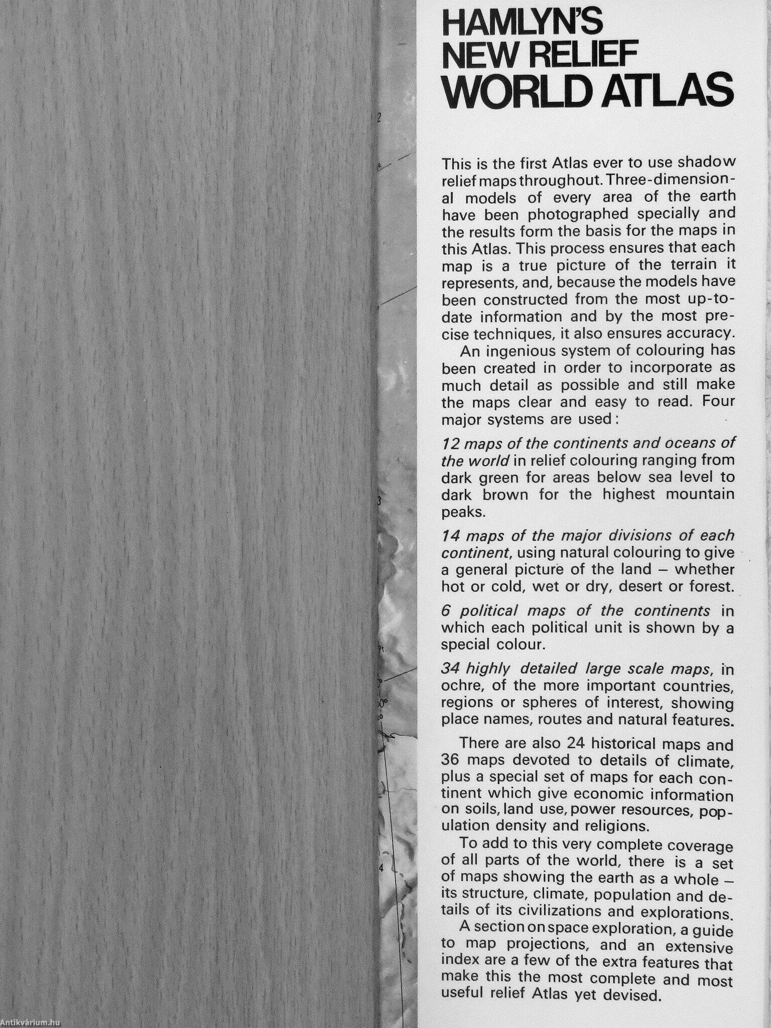
Témakörök
- Idegennyelv > Idegennyelvű könyvek > Angol > Egyéb
- Idegennyelv > Idegennyelvű könyvek > Angol > Természettudományok > Földrajz
- Idegennyelv > Idegennyelvű könyvek > Angol > Történelem > Egyéb
- Természettudomány > Földrajz > Kontinensek földrajza > Téma szerint > Általában
- Természettudomány > Földrajz > Atlaszok, térképek
- Természettudomány > Földrajz > Idegen nyelv > Angol
- Történelem > Idegennyelvű > Angol
- Történelem > Atlaszok, térképek
Megvásárolható példányok
Nincs megvásárolható példány
A könyv összes megrendelhető példánya elfogyott. Ha kívánja, előjegyezheti a könyvet, és amint a könyv egy újabb példánya elérhető lesz, értesítjük.