1.139.395
kiadvánnyal nyújtjuk Magyarország legnagyobb antikvár könyv-kínálatát

Metropolis
Mapping the City


London
| Kiadó: | Bloomsbury Publishing Plc. |
|---|---|
| Kiadás helye: | London |
| Kiadás éve: | |
| Kötés típusa: | Fűzött keménykötés |
| Oldalszám: | 224 oldal |
| Sorozatcím: | |
| Kötetszám: | |
| Nyelv: | Angol |
| Méret: | 29 cm x 29 cm |
| ISBN: | 978-1-8448-6220-7 |
| Megjegyzés: | Színes és fekete-fehér fotókkal, illusztrációkkal. |
Értesítőt kérek a kiadóról
A beállítást mentettük,
naponta értesítjük a beérkező friss
kiadványokról
naponta értesítjük a beérkező friss
kiadványokról
A beállítást mentettük,
naponta értesítjük a beérkező friss
kiadványokról
naponta értesítjük a beérkező friss
kiadványokról
Előszó
Tovább
Fülszöveg
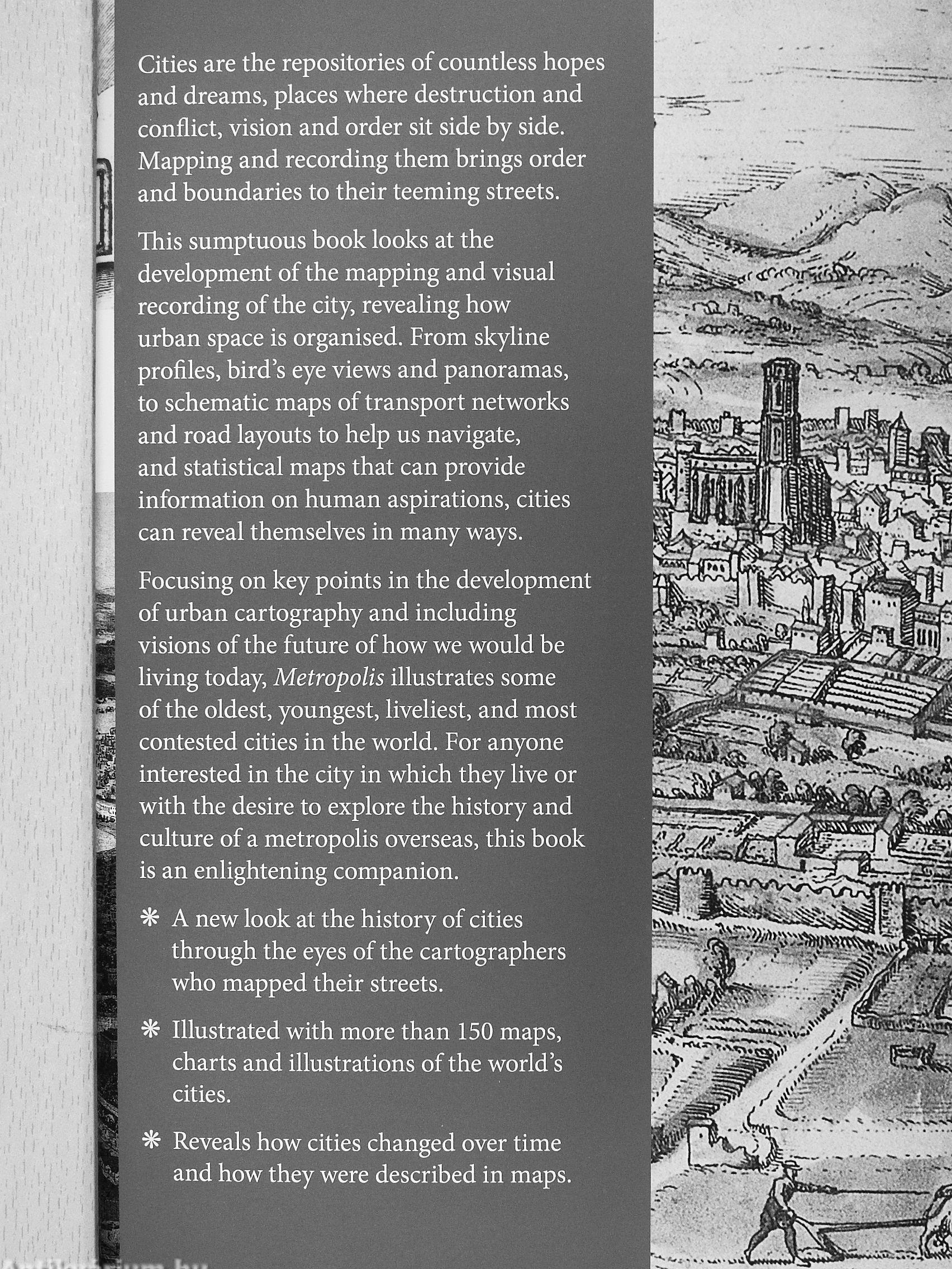
Cities are the repositories of countless hopes and dreams, places where destruction and conflict, vision and order sit side by side. Mapping and recording them brings order and boundaries to their teeming streets.
This sumptuous book looks at the development of the mapping and visual recording of the city, revealing how urban space is organised. From skyline profiles, bird's eye views and panoramas, to schematic maps of transport networks and road layouts to help us navigate, and statistical maps that can provide information on human aspirations, cities can reveal themselves in many ways.
Focusing on key points in the development of urban cartography and including visions of the future of how we would be living today. Metropolis illustrates some of the oldest, youngest, liveliest, and most contested cities in the world. For anyone interested in the city in which they live or with the desire to explore the history and culture of a metropolis overseas, this book is an enlightening... Tovább
Fülszöveg
Cities are the repositories of countless hopes and dreams, places where destruction and conflict, vision and order sit side by side. Mapping and recording them brings order and boundaries to their teeming streets.
This sumptuous book looks at the development of the mapping and visual recording of the city, revealing how urban space is organised. From skyline profiles, bird's eye views and panoramas, to schematic maps of transport networks and road layouts to help us navigate, and statistical maps that can provide information on human aspirations, cities can reveal themselves in many ways.
Focusing on key points in the development of urban cartography and including visions of the future of how we would be living today. Metropolis illustrates some of the oldest, youngest, liveliest, and most contested cities in the world. For anyone interested in the city in which they live or with the desire to explore the history and culture of a metropolis overseas, this book is an enlightening companion.
A new look at the history of cities through the eyes of the cartographers who mapped their streets.
Illustrated with more than 150 maps, charts and illustrations of the world's cities.
Reveals how cities changed over time . and how they were described in maps.
-------
Vissza
Témakörök
- Szociológia > Településszociológia > Város
- Idegennyelv > Idegennyelvű könyvek > Angol > Művészetek > Építészet
- Idegennyelv > Idegennyelvű könyvek > Angol > Természettudományok > Földrajz
- Idegennyelv > Idegennyelvű könyvek > Angol > Szociológia > Településszociológia > Város
- Természettudomány > Földrajz > Általános gazdasági földrajz > Társadalom és környezet
- Természettudomány > Földrajz > Általános gazdasági földrajz > Településföldrajz
- Természettudomány > Földrajz > Általános természeti földrajz > Geodézia, térképészet
- Természettudomány > Földrajz > Idegen nyelv > Angol
- Művészetek > Építészet > Várostörténet > Külföldi
- Művészetek > Építészet > Idegen nyelv > Angol
- Művészetek > Építészet > Várostervezés, városrendezés > Külföldi


Jeremy Black
Jeremy Black műveinek az Antikvarium.hu-n kapható vagy előjegyezhető listáját itt tekintheti meg: Jeremy Black könyvek, művekMegvásárolható példányok
Állapotfotók
Szép állapotú példány.
Állapot:
Jó
7.800 ,-Ft
39
pont kapható
Kosárba